Context and objectives of the study
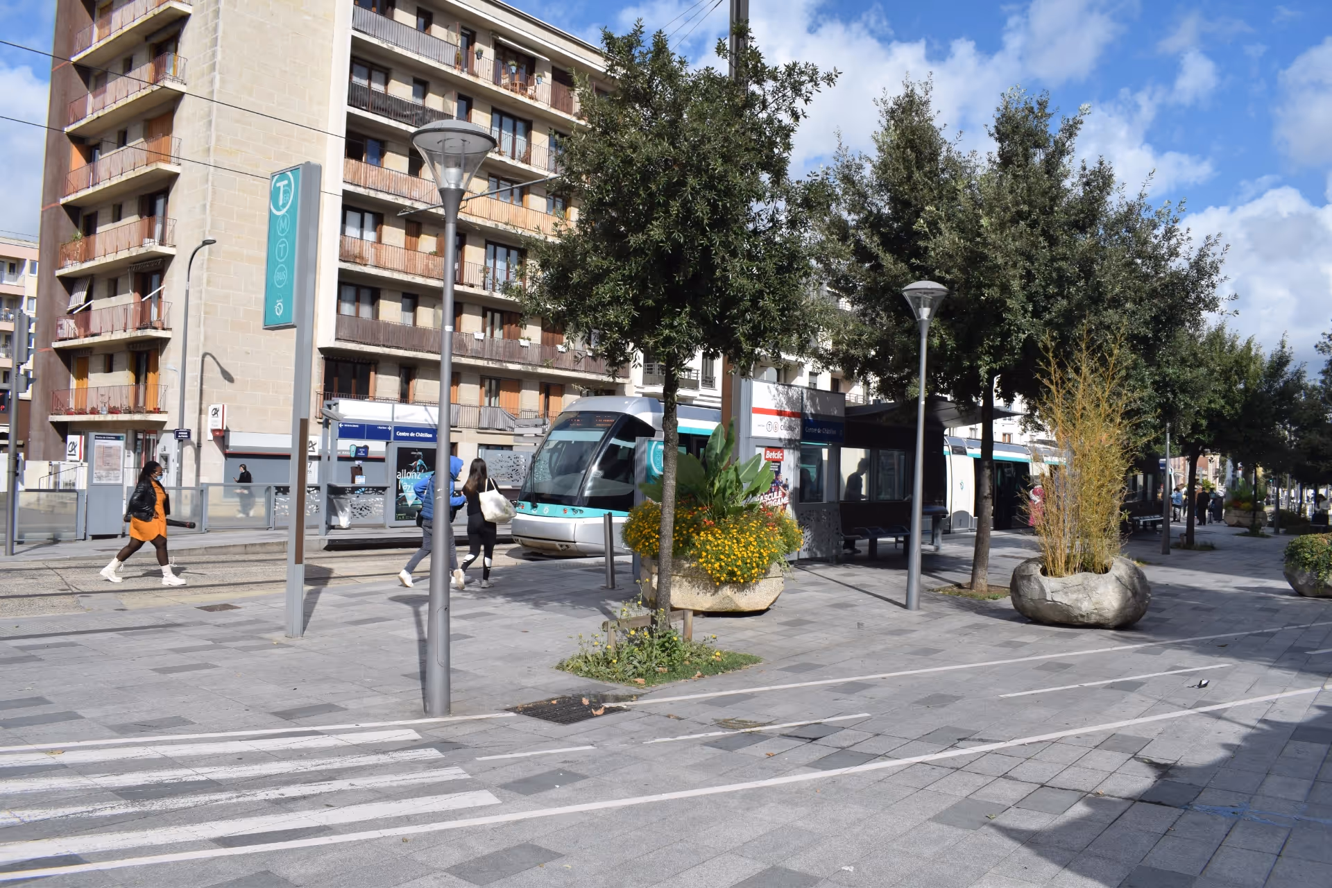
Connected to the heart of Paris Paris by metro line 13 – and soon to be served by metro line 15 whose construction is currently underway – the city of Châtillon is undergoing rapid growth. Châtillon is home to over 37,000 residents today, and the continued increase in population is driving urban densification. In light of this, municipality sought to reimagine its transport plan, allocating public space more equitably among all users, including motorists, cyclists, pedestrians, and public transport riders. They prioritized active mobility, recognizing its importance for the health and well-being of the community. The study sought to conduct a comprehensive analysis of travel behaviour in the municipality, develop strategies for redesigning the local mobility system, and define an action plan that is feasible, socially acceptable, and strikes a balance between performance and cost.
Challenges encountered
Technical
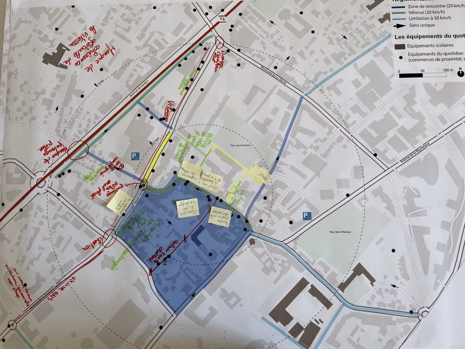
The transport study required a comprehensive analysis of both the current and projected movement patterns within the city. The current situation was examined with the aid of multimodal traffic counts, and future changes in these patterns (notably with the anticipated arrival of metro line 15 of the Grand Paris Express ) were subsequently modelled. By combining field data and traffic modelling, the team developed scenarios for development plans that ensured continued efficiency in the municipality’s transportation services while accommodating new flows.
Environmental
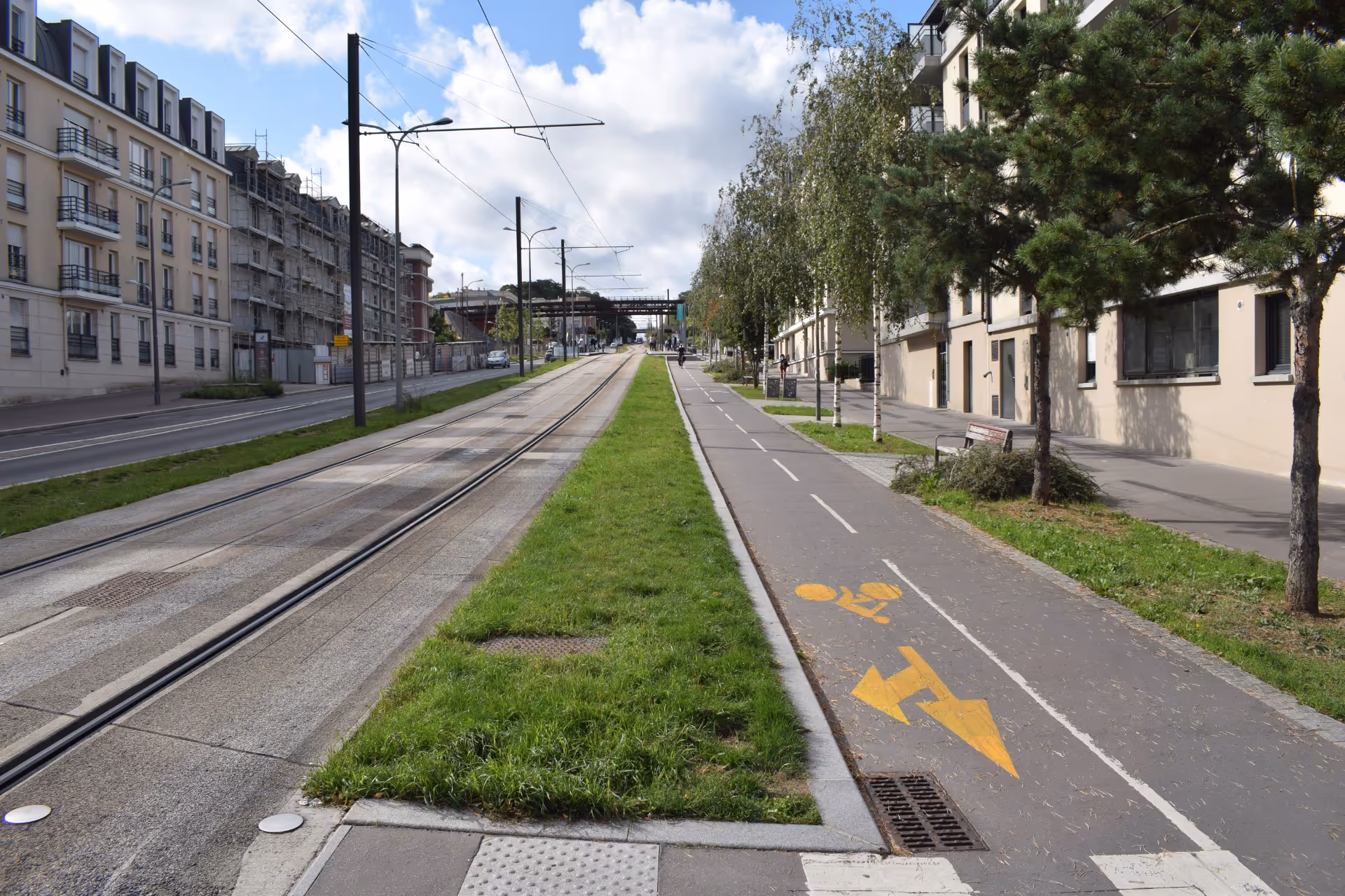
High noise and air pollution levels were recorded near schools and green spaces. In response to this, the study incorporated some recommendations that are environmentally driven, such as planting trees along key routes made possible by reducing car parking, and optimizing urban logistics, with a focus on decarbonization.
Transamo’s mandates
The study was carried out in three phases. For the first months, Transamo undertook a comprehensive evaluation of the local transportation system. This process consisted of identifying routes and bottlenecks, interviewing stakeholders, holding public consultations, and analyzing data provided by the subcontractors, Alyce and Logicités.
In the next phase, Transamo drew up and evaluated three scenarios for streamlining transportation and other urban developments, taking into consideration cost, implementation time, performance, and acceptability. They were created in consultation with elected officials, municipal staff, and residents, and the preferred option was chosen based on its alignment with community priorities.
Finally, the selected scenario was developed into a practical plan based on six primary areas. For each initiative presented in the plan, we prepared a comprehensive action plan that includes a budget, timeline, and conceptual designs for crucial areas. We also established governance structures, such as steering and technical committees, to guarantee the plan’s successful implementation.
Governance
The City of Châtillon led the project, and Transamo oversaw its management. The Transamo team was often present at the site to conduct surveys and public consultations. The team was also involved in steering committees attended by elected officials, and technical committees with municipal services, partners (Logicités for urban logistics and Alyce for surveys), and community representatives. Throughout the process, public sessions were held to guarantee community involvement and approval of the final plan.
Territorial impact
The research suggested decreasing parking spots by 14% (approximately 660 spots), planting 25 trees along revamped roads, and implementing 30 km/h zones throughout the city. These initiatives are intended to slow traffic, enhance safety around schools, and create more public space for active transportation.
Key figures
- Six multimodal traffic counts conducted.
- Five surveys on the topic of origins and destinations.
- Five public consultation workshops.
- More than seventy concrete phases.
- Three key areas with conceptual diagrams for planning.
Key takeaways
This research highlights Transamo’s proficiency in overseeing intricate initiatives and its extensive range of skills in various areas of mobility research, including multimodal analysis (traffic counts, origin-destination surveys), modelling flow and impact, and the strategic and operational planning of mobility alternatives. It also emphasizes Transamo’s exceptional abilities in facilitating collaborative decision-making processes.
Frequently asked questions (FAQ)
What is a traffic count?
It is the manual or automatic collection of data on the number and type of users (cars, trucks, bicycles, pedestrians) at key points and times. This information is then analyzed to understand traffic patterns.
What is traffic modelling?
It's a computer simulation, based on traffic count data and origin-destination surveys, which enables different layouts to be tested virtually without interrupting the existing service.
How were residents’ expectations gathered?
By using a mixed-method approach: field and online surveys, participatory workshops, and targeted interviews. All these methods were refined and validated in the steering and technical meetings.
Share your experiences
Does your organization face similar challenges? We’re eager to hear about the strategies you are implementing. The Transamo Canada team is always ready to connect, learn more about your initiatives, and offer our experience.
Contact us at contact_transamo.canada@transamo.com